Ulsan Walking and Outdoor Courses Worth Doing (2026)
Ulsan's coastal trails and mountain walks rival Busan's popularity but draw a fraction of the tourists. Here's the insider guide to 7 unmissable outdoor courses
# Ulsan Walking and Outdoor Courses Worth Doing (2026)
Ulsan sits 400km southeast of Seoul, yet most travelers skip it entirely—driving straight through to Busan or Jeju. That's exactly why you should go. The city has some of South Korea's most dramatic coastal walks, accessible mountain trails, and whale-watching routes that feel genuinely undiscovered. Unlike the crowded peaks near Seoul or the Instagram-flooded beaches of Busan, Ulsan's outdoor courses reward you with solitude, better air quality, and landscapes that feel earned rather than performed.
Why Ulsan's Outdoor Courses Are Invisible to Most Foreigners
Ulsan isn't marketed as a tourism destination—it's an industrial city. Samsung shipyards, petrochemical plants, and steel factories dominate the skyline. Tourist boards don't sell this. But what they overlook is that Ulsan anchors the Nakdong River estuary and the East Coast, giving it access to:
- Whale migration routes (October–November, April–May)
- 90km of Nakdong River greenways
- Pristine mountain ranges largely free of cable cars and gift shops
- Coastal cliffs that rival any beachfront walk in Korea
The lack of English signage, limited international accommodation options, and zero celebrity Instagram influence mean trails stay quiet year-round. Local hikers know this. Foreigners don't.
7 Specific Outdoor Courses You Should Do
Location: Central Ulsan, from Jung-gu Time: 2–2.5 hours Difficulty: Easy Cost: Free
This is your entry point. The Taehwagang Park loop follows the Nakdong River through manicured but genuinely beautiful parkland. Unlike Seoul's Hangang parks, you'll see fewer joggers and phones. The trail connects to the Nakdong Estuary Greenway, which extends 90km total—but the 7.5km core section around the park is perfect for a morning walk.
Stop at the riverside cafés near the park entrance: coffee runs ₩4,500–6,000. The walking path is paved, stroller-friendly, and has regular rest stations with filtered water.
Location: Ulju-gun, east of central Ulsan Time: 4–5 hours (full circuit) Difficulty: Moderate–Hard Cost: Free; parking ₩2,500
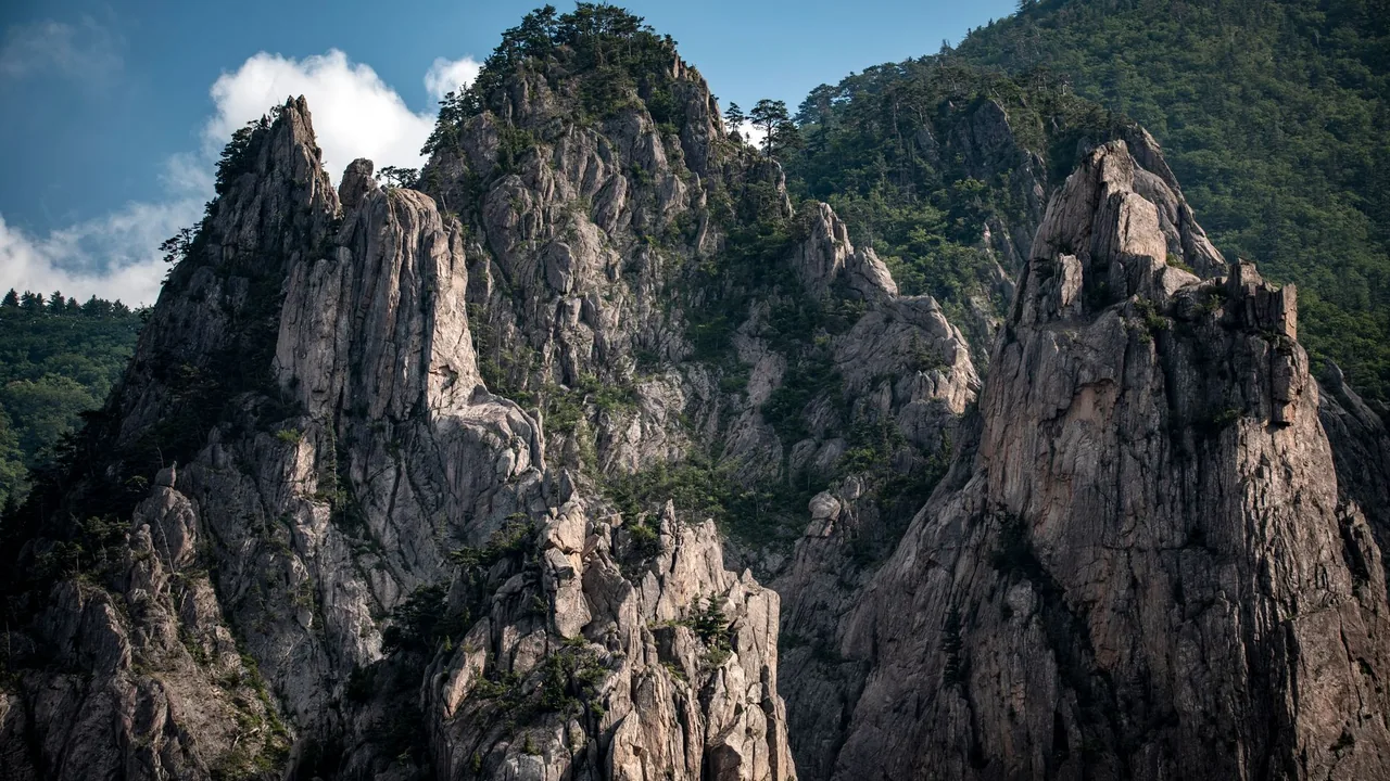
This is the hike serious walkers come for. Yeongnam Alps isn't a single peak—it's a ridge circuit through six peaks with exposed rocky sections, chain descents, and 360° views over Ulsan to the East Sea. The route is unmarked in places, so bring a naver map offline version or download the Korean hiking app Joker Map.
Parking at the Gajisan entrance is ₩2,500. No food vendors on the trail, so pack 1.5L of water and energy bars (cost: ₩3,000–8,000 from CU convenience stores at the base).
Best season: May–June, September–October. Summer heat can trap you mid-ridge.
Location: Ulju-gun, easternmost point Time: 1.5–2 hours Difficulty: Easy Cost: Free
Ganjeolgot is the easternmost point of mainland South Korea. The walk loops a rocky headland with sea views that open suddenly. On clear days, you can see 30km across the East Sea. This trail deserves more attention—it's photogenic without being Instagram-destroyed.
The coastal path is paved for the most part, with a small museum (₩2,000 entry) celebrating the location's geographic significance. Parking is free. There's a small café at the trailhead selling coffee (₩5,000) and kimbap (₩6,000).
Location: Nam-gu, coastal area Time: 1.5–2 hours Difficulty: Very Easy Cost: Free; binoculars rental ₩5,000
If you visit during October–November or April–May, this is your whale-watching base. The wetland reserve is home to over 170 bird species and is a crucial waypoint for East Asian migratory whales. The walking path winds through boardwalks and observation towers—completely flat, designed for families and birdwatchers.
The Ulsan Whale Museum is adjacent (₩5,000 entry, worth it). Binoculars rental from the visitor center costs ₩5,000 for 2 hours. Local guide services are available through the center at around ₩40,000 for a 2-hour group tour in Korean (English guides available with 48-hour notice).
Location: Ulju-gun, north of Yeongnam Alps Time: 5–6 hours Difficulty: Hard Cost: Free; parking ₩2,500
Gajisan (1,240m) is the anchor peak of the range. Unlike Yeongnam Alps, this route is well-marked and slightly less exposed, though steeper. Most hikers start from the southern entrance (Seongnamsa Temple trail) and summit in 3 hours, then descend via a different route for the full circuit.
Temple entry: ₩3,000. Mountain hut cafés at the summit sell ramyeon (instant noodles) for ₩4,000 and instant coffee for ₩2,000. Bring water anyway—hut supplies sell out on weekends.
Location: Nam-gu, south-central Time: 2 hours Difficulty: Easy Cost: Cable car (optional) ₩8,000; parking ₩2,000
This trail combines urban park walking with forested sections. Apsan Park is accessible by cable car (saving 1.5 hours of climbing), but the walk down through pine forest is the real appeal. You'll see fewer tourists here than at similar spots in Daegu or Busan.
The park café at the summit serves basic meals (kalguksu noodles ₩8,000, hot coffee ₩4,500). You can skip the cable car and hike up—takes about 90 minutes from the base.
Location: Nam-gu, harbor district Time: 45 minutes–1 hour Difficulty: Very Easy Cost: Free; whale-watching boat tours ₩35,000–50,000
If you can't commit to a full hiking day, this short coastal path connects the historic whaling district (now a cultural preservation area) to a functioning lighthouse. It's more of a stroll than a hike, but it gives genuine context to Ulsan's relationship with the sea.
Several boat tour operators run from the harbor (₩35,000–50,000 per person for 2–3 hours). Boats are small, authentic fishing vessels—not tourist ferries. Whale sightings in season are genuine (not guaranteed, but Ulsan's location means regular encounters).
8 Essential Etiquette and Practical Tips for Ulsan Walking Trails
- Bring offline maps. Naver Map and Kakao Map have the best Korean trail data. Download them before you go—LTE coverage drops on ridge sections.
- Mountain hut culture is real. If you stop at a trail-side café (called sanjang), you're expected to buy something. A coffee or ramyeon costs ₩3,000–6,000 and directly supports locals.
- Greet other hikers in Korean. Even a simple "안녕하세요" (annyeonghaseyo) with a bow gets genuine responses. Older hikers especially appreciate this.
- Take all trash with you. Ulsan trails are cleaner than Seoul peaks because locals enforce this strictly. Don't be the exception.
- Weather changes fast on coastal routes. Check the Ulsan-specific 일기예보 (weather forecast) the morning of your hike. East Coast fog can arrive in 20 minutes.
- Pay parking fees directly. Most Ulsan trail parking uses old-style attendant booths, not automated systems. Have ₩2,000–3,000 cash ready.
- Respect private temple grounds. Some trails cross Buddhist temple property. Remove hats indoors, speak quietly, and never photograph monks.
- Whale-watching season matters. October–November and April–May are peak migration. Winter and summer sightings are luck-based; plan accordingly.
- Convenience stores are your supply chain. Every trailhead and entrance has a CU or GS25. Stock water (₩1,500 per 500ml) and energy bars before heading to lesser-trafficked peaks.
- Don't hike alone on unmarked routes. Yeongnam Alps is beautiful, but navigation failures do happen. Go with a buddy or a local guide (₩60,000–100,000 for private 4-hour guided hikes through Ulsan tourism office).
FAQ: Ulsan Walking Trails
A: May–June and September–October are ideal—moderate temperatures, clear skies, and low rain risk. July–August brings humidity that makes higher peaks uncomfortable by noon. Winter (December–February) is clear but cold; trails can ice over on north-facing slopes. Spring (April) offers whale migrations and wildflowers on lower routes like Taehwagang Park.
A: Only Yeongnam Alps requires serious navigation caution due to unmarked sections and exposure. Everything else is well-marked. Beginner hikers on Gajisan or Yeongnam Alps can arrange guides through the Ulsan Tourism Board (tel: +82-52-225-4343) for ₩60,000–100,000 for 4 hours. Whale-watching tours always use local guides and are essential for safe navigation to viewing spots.
A: Yes, with caveats. Taehwagang Park, Oesong Wetland, Apsan Park, and Jangsaengpo Harbor are entirely stroller-accessible and suitable for children under 10. Yeongnam Alps and Gajisan are for children 12+ with mountain experience. Ganjeolgot is safe for families but has steep rocky sections requiring careful footing.
A: Ulsan has a small airport (USN) with limited flights from Seoul. Most travelers take the KTX train (Seoul to Ulsan, 2.5 hours, ₩38,000–48,000) or express bus (3.5 hours, ₩22,000). Renting a car is highly recommended for trail access—most trailheads are 20–40 minutes outside the city center. Car rental from Ulsan Station: ₩50,000–80,000 per day. Taxis to trailheads run ₩25,000–40,000 from the city center.
A: Ulsan is Korea's best mainland whale-watching location, with legitimate sightings of minke whales, sperm whales, and dolphins during migration seasons (April–May, October–November). Tours operate from Jangsaengpo Harbor daily in season. Book through the harbor information center (+82-52-256-0157) or via local hotels. Tours cost ₩35,000–50,000 per person for 2–3 hours. Success rate is ~70% in peak seasons; winter and summer have lower odds but calmer seas.
A: Minimal. Major trailheads (Taehwagang, Apsan, Yeongnam Alps) have basic English directional signs. Remote trails are Korean-only. Download Naver Map offline before arrival—it's your real navigation tool. Consider hiring a local guide (₩60,000–100,000) for complex routes, or join a Korean hiking club group (posted on Naver Cafe bulletin boards under "울산등산").
Final Thought: Why Ulsan Matters Now
Ulsan won't stay quiet. The city is investing heavily in tourism infrastructure—new mountain huts, improved parking, and English signage should appear by 2027. But right now, in 2026, you get the rare window where these trails are genuinely undiscovered. The air is cleaner than it was five years ago. The locals know what they have.
Start with Taehwagang Park if you want confidence. Move to Ganjeolgot if you want views. Go to Yeongnam Alps if you want to earn something. And time your trip for whale season if you want to see why Ulsan's relationship with the sea shaped everything.
Ask the KORLENS AI chat for Ulsan outdoor and walking suggestions based on your interests. It is an AI assistant that replies in seconds, not a human team, and it works from Korea Tourism Organization open data. Also visiting Seoul? Seoul Local Picks covers Seoul only.
Or explore more Korean outdoor routes: Hidden hiking trails in Daegu and the Nakdong region.
Next Step
About this guide
KORLENS is run by one person (KunStudio, a solo studio in Korea), not an editorial team. Guides are AI drafts based on public sources; some use Korea Tourism Organization TourAPI open data. KORLENS does not claim on-site visits or scheduled re-checks, so confirm hours, prices and closures with the venue before you go. Page last edited: 2026-06-22.
Plan your Korea trip with the KORLENS AI chat
Got a follow-up question after reading this? Ask the KORLENS AI chat in plain English. It is an AI assistant, not a person, and it replies in seconds with places from Korea Tourism Organization open data.
Ask the KORLENS AI chatCurious about Korean Saju? Try sajuapp.app
1,000-year-old Korean astrology, decoded by AI — available in 9 languages.
Is it worth visiting, the best time to go, crowds and real cost.
Solo Female Travel in Ulsan: 2026 Safety + Practical Guide
Ulsan isn't Seoul, and that's exactly why solo female travelers are sleeping better here. A local insider's breakdown of real safety, neighborhood picks, and wh
Ulsan's Hidden Restaurants Locals Don't Want You to Know (2026)
Skip the tourist traps. Discover Ulsan's best-kept culinary secrets where locals eat—real prices, real food, real flavor in industrial Korea's most underrated c