Gwangju Walking and Outdoor Courses Worth Doing (2026)
Skip Seoul's crowded trails. Gwangju's walking courses offer authentic urban parks, mountain routes, and riverside paths—with prices half the capital's cost.
# Gwangju Walking and Outdoor Courses Worth Doing (2026)
Opening: The Underrated Walking Capital
While backpackers queue for the Bukhansan trails outside Seoul and tourists mob Jeju's coastal paths, Gwangju quietly sits 330km to the south with some of South Korea's most rewarding walking courses—and almost none of the crowds. You won't hear about these routes in mainstream travel guides, which is precisely why locals keep returning here. The city's outdoor infrastructure is genuinely excellent: well-maintained paths, clear signage, affordable food stops, and a reputation for actual tranquility.
Why Gwangju's Outdoor Courses Stay Off Most Travelers' Radars
Gwangju suffers from a simple geography problem: it's not Seoul, not Busan, and not famous enough to justify a "side trip" in most 10-day Korea itineraries. This regional city of 1.4 million has the trails but lacks the Instagram cachet. Tour operators don't market Gwangju's Mudeungsan Mountain or the Yeongsan River paths because they're harder to monetize than bundled city tours. Local Korean hikers, however, consider Gwangju's autumn mountain walks and spring riverside strolls essential. You benefit from this gap: shorter wait times, lower prices, and genuinely helpful locals who aren't tired of tourists.
The city also sits perfectly positioned for outdoor access—surrounded by mountains to the north (Mudeungsan range), with urban parks that have been systematically upgraded since 2015. Most foreign visitors simply don't know to look here.
5 Must-Do Gwangju Walking Routes and Outdoor Courses
Distance: 8.2km | Duration: 4–5 hours | Difficulty: Moderate to challenging
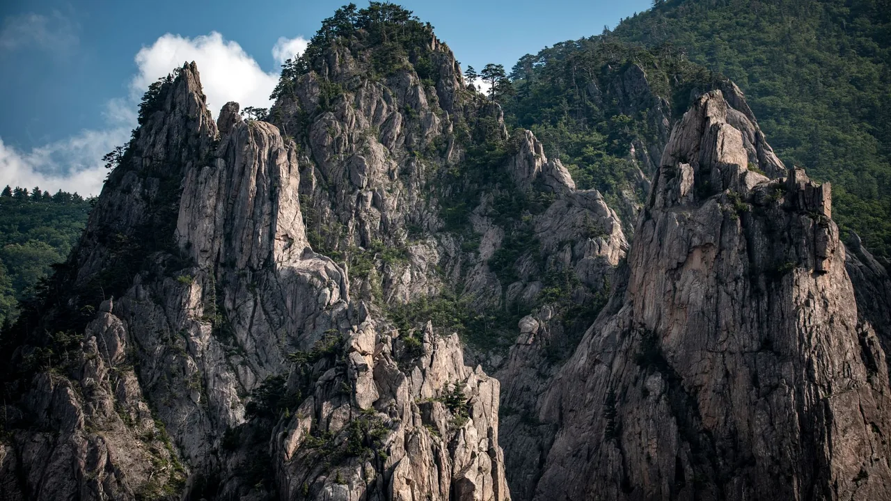
This is the crown jewel. Mudeungsan dominates Gwangju's skyline, and the main ridge walk from Beannae Entrance to Jeungsinbong Peak (1,084m) is a technically sound hike with dramatic granite outcrops and valley views. You'll encounter rope sections and steep scrambles—not a casual stroll, but well-within reach for anyone with basic fitness.
Cost breakdown: Parking at Beannae (₩5,000), gimbap lunch at the base (₩8,000–12,000 per person), water and snacks along the trail are generally available at small mountain shelters (₩2,000–3,000 for bottled water).
Pro move: Start at 6:30 AM if you're going in summer (fewer crowds by 8 AM, cooler temps). The upper ridge is exposed—sunscreen essential.
Distance: Varies (2km–12km sections) | Duration: 30 min–2.5 hours | Difficulty: Easy
Gwangju's Yeongsan River corridor is a purpose-built greenway that locals use daily. Unlike Seoul's Han River, you'll see working neighborhood life: fishers, elderly couples walking, families on weekend outings. The path runs continuously alongside the river with multiple entry points, rest areas, and small cafés. The central section between Gwangju Bridge and Sungdong Bridge (4.5km) is the most scenic.
Cost breakdown: Free access. Coffee at riverside cafés costs ₩4,500–6,500. A simple kimbap lunch nearby: ₩8,000–10,000.
Real insight: Go on a weekday morning if you want solitude. Weekends attract families, especially after 10 AM.
Distance: 2.8km loop | Duration: 1–1.5 hours | Difficulty: Easy to moderate
Jungoe Park sits within the city and offers a legitimate hill walk without committing to a full mountain day. The stone-step loop takes you through oak forest with small pavilions and viewpoints overlooking the city. It's touristy by Gwangju standards, but that means the trail is maintained beautifully and has proper facilities.
Cost breakdown: Free entry. Parking ₩3,000 (4 hours). Street food vendors near the entrance sell hotteok (₩3,000) and fresh citron tea (₩5,000).
Best time: Early morning or late afternoon to avoid the midday heat and the school-group rush.
Distance: 1.2km main forest path + 3.5km extended loop | Duration: 1–2 hours | Difficulty: Easy
A short drive from Gwangju gets you to one of Korea's most atmospheric natural sites. The Juknokwon (Bamboo Forest) is a managed path through dense bamboo groves with genuine temple connections and a meditative quality. It's become slightly more touristy post-2023, but the early morning walk (before 8 AM) still feels serene.
Cost breakdown: Parking ₩5,000. Forest entrance ₩5,000. Simple vegetarian meals at nearby temple restaurants ₩10,000–15,000.
Transportation: Take a local bus from Gwangju's Gwangju Bus Terminal (Line 72, ₩5,450, 45 minutes) or hire a taxi (₩80,000–100,000 for driver wait-time included).
Distance: 2.5km loop | Duration: 1.5–2 hours | Difficulty: Easy
This isn't wilderness, but it's a legitimate walking experience that combines Gwangju's modern identity with nature. The promenade winds through the Mukgyesan foothills with art installations, small galleries, and landscaped viewing areas. Popular with locals on weekend evenings.
Cost breakdown: Free walking. Budget ₩15,000–30,000 if you stop at any gallery café or restaurant along the route.
Vibe check: This route works best if you pair it with gallery visits. The walk itself is the connector, not the main event.
Distance: 5.2km | Duration: 2–2.5 hours | Difficulty: Easy to moderate
Southwest of the city center, Baegun Mountain is frequented mostly by locals. The forest is dense and cool even in summer, with proper trail markers and minimal crowds compared to Mudeungsan. The ascent is gradual, making this ideal for a midweek morning escape.
Cost breakdown: Free. Parking ₩3,000. Street food and drinks near trailhead ₩5,000–8,000.
Local secret: The restaurant at the halfway shelter does a decent nokcha (green tea) and hotteok combo for ₩8,000.
Practical Tips and Etiquette for Gwangju Walking Courses (8 Essential Rules)
- Start walks early—sunrise to 8:30 AM is golden. Mountain heat builds quickly; crowds arrive after 9 AM. Mudeungsan sees traffic jams in parking by 10 AM on weekends.
- Bring your own water (at least 1.5L per person). Trail shelters exist on major routes but aren't guaranteed. Convenience stores near trailheads are your backup (GS25, CU, Emart24 scattered throughout).
- Wear proper hiking boots, not trainers. Gwangju's trails have rocky, root-heavy sections. A single twisted ankle means a long rescue descent.
- Pack out everything you pack in—no exceptions. Koreans take mountain cleanliness seriously. Leaving trash is genuinely frowned upon and occasionally reported to park rangers.
- Use designated rest areas and don't make noise after dusk. Many routes pass near residential areas. Loud groups on evening walks disturb locals.
- Respect temple grounds if your route passes through them. Don't enter restricted areas, remove shoes where indicated, and be quiet inside structures. Photography is often permitted but ask first.
- Check seasonal closures before heading out. Some routes close during winter snow or during heavy rain (especially July–August monsoons). The Gwangju Parks and Recreation site (gwangju.go.kr) updates this regularly.
- Always tell someone your route and expected return time. Cell service is generally solid, but mountain dead zones do exist. A text to your accommodation covers basic safety.
- Don't feed wildlife—ever. Mountain monkeys and boar are present in Gwangju's ranges. Fed animals become aggressive.
- Wear insect repellent (April–October). Mosquitoes and tiny leeches (rare but possible after rain) are present. A DEET-based spray from any convenience store (₩8,000–12,000) is essential.
Frequently Asked Questions
A: Spring (April–May) and autumn (September–October) are optimal. Spring offers blooming wildflowers and moderate temperatures; autumn brings clear air and stunning foliage. Summer is hot and humid (30°C+) but manageable with early starts. Winter (December–February) is cold but dry—Mudeungsan gets occasional snow, which adds difficulty but looks spectacular. Avoid July–August if possible; monsoon rain can make trails muddy and unsafe.
A: Yes, with modifications. Yeongsan River path is completely flat and suitable for all ages. Jungoe Park and Baegun Mountain are manageable for reasonable fitness levels. Mudeungsan's main ridge is genuinely challenging—reserve this for teenagers and adults with regular exercise habits. For elderly visitors, the Bamboo Forest and Gwangju Art Street promenades are perfect: short, paced, and culturally rich without physical strain.
A: Seoul's trails (Bukhansan, Namsan) are well-maintained but crowded—easily 500+ hikers on a weekend morning. Gwangju trails match Seoul's infrastructure quality (marked paths, emergency services) but see a fraction of the traffic. You get authentic mountain scenery without the queueing. Additionally, Gwangju's trails cost significantly less (parking, food) and the local hiking community is genuinely welcoming to foreigners. Seoul trails feel like duty; Gwangju feels like discovery.
A: Solo walking is completely safe and typical. Gwangju has local hiking clubs (contact the Gwangju Tourism Organization), and guided group hikes can be arranged, but they're primarily in Korean. If you prefer guided exploration in English, local travel agencies in downtown Gwangju (around Chungjang-ro) can arrange basic orientation hikes for ₩80,000–150,000 per person. Most visitors walk independently after a quick map check at the trailhead.
A: Before: Light carbs and protein 2–3 hours before departure. Skip heavy meals. During: Energy bars, dried fruit, or Korean-style gimbap. After: Proper meals with protein and vegetables within 1–2 hours of finishing. Gwangju restaurants near trailheads serve samgyetang (ginseng chicken soup, ₩15,000–20,000) or galbitang (short-rib soup, ₩16,000–22,000)—both excellent post-hike recovery meals. Convenience stores (available everywhere) have adequate sandwich and kimbap options (₩5,000–8,000).
A: Gwangju's walking trails are generally very safe, with regular foot traffic and emergency call boxes on major routes. Women solo hikers are common, particularly on Mudeungsan and river paths. Standard precautions apply: tell someone your plans, carry a charged phone, avoid routes after dark (trails aren't lit), and trust your instincts. The main "risk" is overexertion or weather—not crime or harassment. Local hiking communities are respectful and inclusive.
Closing: Your Next Step into Gwangju's Outdoor Scene
Gwangju's walking trails and outdoor courses deserve their place on Korea's travel map. You won't find the glossy hype of Jeju or the crowds of Seoul, but you will find genuine, well-maintained paths through forests and rivers that locals treasure. Start with the Yeongsan River on your first day (easy, accessible, no commitment), then move to Mudeungsan when you're ready for something with teeth.
Plan a 2–3 day Gwangju visit around your walking schedule. Arrive Friday evening, tackle a moderate route Saturday morning (Jungoe Park or Baegun Mountain), and summit Mudeungsan Sunday early before returning to the city for lunch and travel out.
Ask the KORLENS AI chat for Gwangju outdoor and walking suggestions based on your interests. It is an AI assistant that replies in seconds, not a human team, and it works from Korea Tourism Organization open data. Also visiting Seoul? Seoul Local Picks covers Seoul only.
The trails are waiting. Gwangju is counting on you to discover them.
Next Step
About this guide
KORLENS is run by one person (KunStudio, a solo studio in Korea), not an editorial team. Guides are AI drafts based on public sources; some use Korea Tourism Organization TourAPI open data. KORLENS does not claim on-site visits or scheduled re-checks, so confirm hours, prices and closures with the venue before you go. Page last edited: 2026-06-10.
Plan your Korea trip with the KORLENS AI chat
Got a follow-up question after reading this? Ask the KORLENS AI chat in plain English. It is an AI assistant, not a person, and it replies in seconds with places from Korea Tourism Organization open data.
Ask the KORLENS AI chatCurious about Korean Saju? Try sajuapp.app
1,000-year-old Korean astrology, decoded by AI — available in 9 languages.
Is it worth visiting, the best time to go, crowds and real cost.
Solo Female Travel in Gwangju: 2026 Safety + Practical Guide
Gwangju is safer than most Korean cities for solo women travelers. Here's what locals know about neighborhoods, prices, and practical survival tips.
Gwangju Rainy Day Itinerary: 15 Things to Do Indoors (2026)
Skip the rain umbrella street crowds. Discover 15 authentic indoor activities in Gwangju—from art museums to jimjilbangs—with real prices and local insider tips